


Today, Teams Stitch Together
Consultants, Spreadsheets, Maps,
and Guesswork.
Outdated, Fragmented, and Unreliable Data
The industry relies on scattered land, policy, environmental, and grid data, creating blind spots and rework.
Slow and Unclear Permitting
Permitting is inconsistent, hard to navigate, and marked by long, unpredictable timelines.
Local and Political Pushback
Community opposition and shifting local policies often halt or reshape projects mid-way.
Grid Capacity Limits
High-demand regions face grid saturation, making interconnection slow or impossible.
Disconnected Workflows
Siting, permitting, policy tracking, and compliance live in separate systems with no feedback loop.
Late-Stage Rejection Risk
Poor early risk visibility leads to redesigns or rejection late in the process.
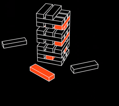
Every stalled site pushes projects back by months
Every misstep costs millions
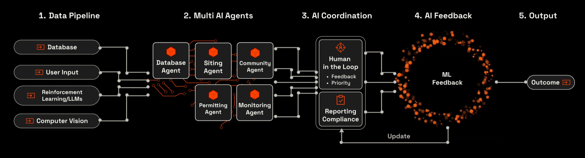
NYXIUM Intelligence:
The Path From Input to a Site You Can Actually Build On
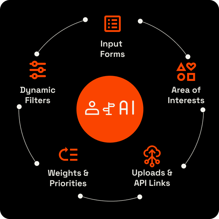
NYXIUM scans the real world, evaluates every constraint, and gives you a final site with full compliance checks.
Turns Raw Data Into Reliable Siting Decisions
NYXIUM integrates grid access, land constraints, community friction, and permits across every step, and the outcome is a site that can confidently move forward.
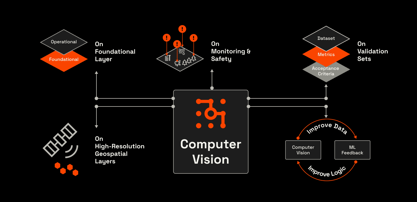
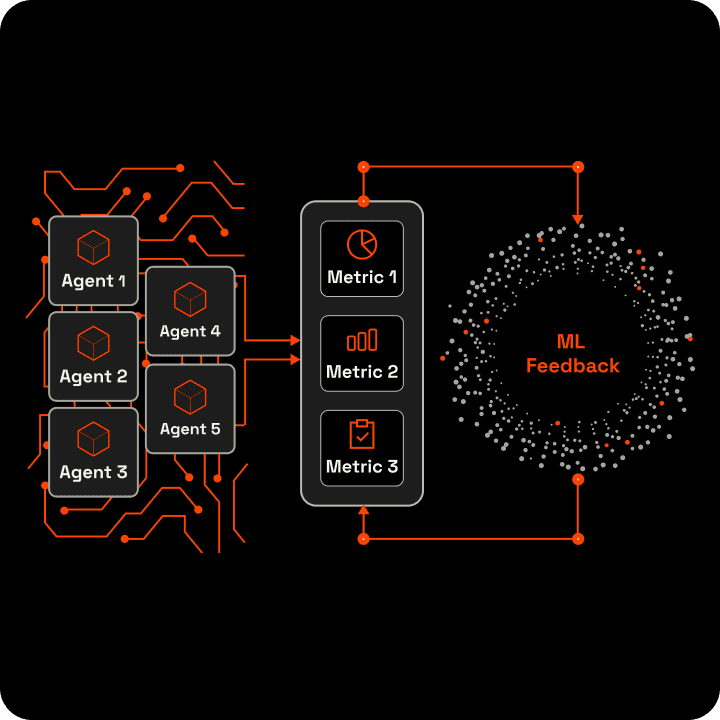
Better Data Means Better Decisions
NYXIUM uses computer vision, validation sets, and continuous feedback to keep data and decision logic accurate — so your siting decisions always reflect the real world.
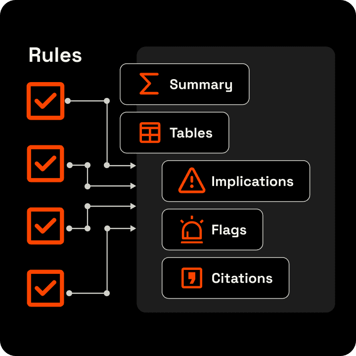
Know Every Permit and Condition Before You Choose a Site
After NYXIUM identifies the most viable sites, the knowledge graph reveals the full regulatory path behind each option. It connects permits, agencies, conditions, and timelines, showing what is needed, why, and in what order.

Our Unbeatable Edges
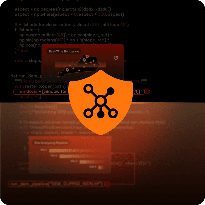
We harness AI to autonomously extract insights, learn, and make decisions—combining geospatial processing, computer vision, web and document retrieval, and narrative intelligence to generate fully referenced siting and compliance reports optimized through reinforcement learning.

Reliable. Secure.
Built for High-Stakes Projects.
Your data stays isolated, encrypted, and never used to train shared models — while NYXIUM continuously improves its own logic in the background.
$2-5 M
Cost Saving Per Project
site deployability
Frequently Asked Questions
Is NYXIUM only for the US, or does it work globally?
NYXIUM is built for global use. The platform follows one unified structure for data, regulations, policies, and scoring, so new countries can be added quickly without redesigning the system. It already supports US-level detail and is expanding with the same depth across the UK, EU, Australia, New Zealand, and Asia. This lets cross-border teams run consistent siting and risk checks anywhere.
How steep is the learning curve for new users?
NYXIUM is designed so that anyone on the team can use it without special training. The interface guides the user from project setup to site results with clear steps, clean maps, and automatic explanations. All heavy work happens behind the scenes through multi-agent AI. Most users become comfortable within one session because the workflow mirrors how project teams already think about land, grid, policy, and approvals.
How accurate are NYXIUM’s site decisions?
NYXIUM’s accuracy comes from:
• Proprietary data — updated environmental, community, resources, land, grid, and policy layers
• Clear scoring rules — no black-box scoring
• Real project feedback — the system improves as more projects complete
• Satellite and CV checks — real-time detections of lines, substations, and land changes
Because the scoring is transparent and backed by actual outcomes, teams can trust that top-ranked sites reflect real conditions.
What benefits will my team see right away?
NYXIUM gives teams:
• faster early screening
• fewer dead-end sites
• minimize community push backs
• clear reasons behind every score
• multi-state or multi-country comparisons
• early insight into likely permits and timelines
• support for investor and internal decisions
This reduces risk, shortens planning time, and strengthens each project’s starting position before entering land deals or permitting.
Pri